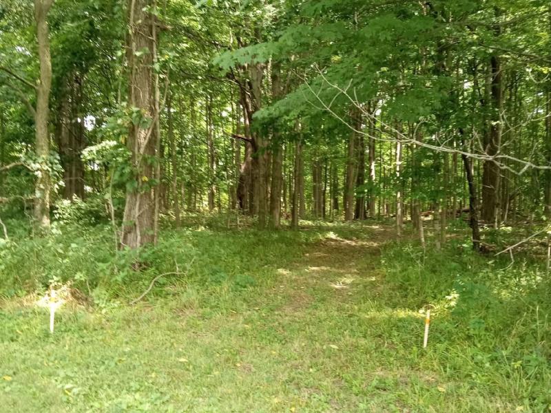
0 E 214th Street, Sheridan, IN 46069
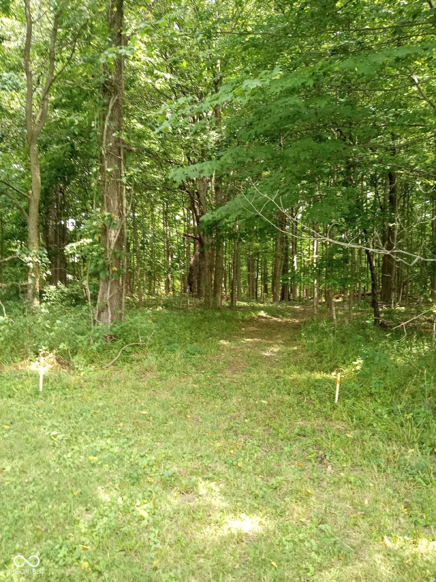
$350,000
2.5 acres
Estimated Payment
$ 1,801 /mo. †
6.67%
APR for
30 yrs.
$0 in taxes
Change Loan Terms
-
Other Residential
Property type -
2.5 acres
Lot size
Explore this Property
Courtesy Of Compass Indiana, LLC
(317) 563-5051
Property Features
-
Architecture StyleOther
-
Lot Size2.5 Acres
Home seller CENTURY 21 Scheetz
Get to know the neighborhood. A local affiliated CENTURY 21 office will help you set up tours, give advice, and negotiate with sellers.
CENTURY 21 Scheetz
(317) 844-5111Mortgage Calculator
Monthly Payment Breakdown
-
Principle and Interest
$1,801
-
Property Taxes
$0
-
Hazard Insurance
$0
-
Private Mortgage Insurance
$0
-
HOA Dues
$0
-
Total Monthly Payment:
$1,801
Calculators provided for estimating purposes only. Consult with your lender to determine precise payment requirements.
Schools
Westfield Intermediate School
Grades 5-6 Public School
Westfield, IN 46074
3.8 miles
17710 shamrock blvd
1298 total students
20:1 Student teacher ratio
Westfield Middle School
Grades 5-8 Public School
Westfield, IN 46074
3.7 miles
345 w hoover st
1285 total students
17:1 Student teacher ratio
Monon Trail Elementary School
Grades KG-4 Public School
Westfield, IN 46074
2.2 miles
19400 tomlinson rd
513 total students
16:1 Student teacher ratio
Westfield High School
Grades 9-12 Public School
Westfield, IN 46074
3.5 miles
18250 n union st
2527 total students
18:1 Student teacher ratio
| Other Nearby Schools | Distance | Type | Grades | School Rating |
|---|---|---|---|---|
| Sheridan Middle School | 4.1 miles | Public | 6-8 | B+
|
| Sheridan High School | 4.1 miles | Public | 9-12 | B
|
| Washington Woods Elementary School | 4.3 miles | Public | PK-4 | B-
|
| Montessori School Of Westfield | 4.3 miles | Private | PK-8 | |
| Maple Glen Elementary School | 4.3 miles | Public | PK-4 | B+
|
| St Maria Goretti School | 4.4 miles | Private | PK-8 | |
| Union Bible Academy | 4.4 miles | Private | PK-12 | |
| Sheridan Elementary School | 4.5 miles | Public | PK-5 | B-
|
| Oak Trace Elementary School | 4.9 miles | Public | PK-4 | A-
|
| Carey Ridge Elementary School | 5.7 miles | Public | PK-4 | B
|
| Hazel Dell Elementary School | 5.8 miles | Public | KG-5 | B+
|
School information does not guarantee enrollment. School service boundaries are provided as a reference only, may change, and are not guaranteed to be accurate. Contact the school district directly to verify school enrollment eligibility.
Local area information for Sheridan, IN 46069

Tour the area
Schedule a
tour with a
personal guide
Sheridan, IN 46069
This community’s employment is highest in the transportation and administrative support industries. The area’s overall household expenses are above the national average.

have children
Household Expenses vs National Average
Demographic facts
for Sheridan, IN 46069
Sheridan, IN 46069 has a population of 9,994 people in 3,729 households with a median age of 41.6 years old.

since the year 2010
Population is Trending up
households in 5 years
Community Population By Age
Community Population By Ethnicity
| White | 86% |
| Hispanic | 7% |
| Other | 4% |
| Black | 3% |
| Asian | 1% |
| Native American | <1% |
Economics
for Sheridan, IN 46069

Household Expenses vs National Average
Household by Income
Transportation to Work
- Drive 88%
- Work from Home 9%
- Walk or Bike 4%
- Public Transit 0%
Occupancy by Type
| Owned | 2,716 | 68% |
| Rented | 1,012 | 25% |
| Vacant | 277 | 7% |
White vs Blue Collar Jobs
| White Collar | 69% |
| Blue Collar | 31% |
Family & Education Facts
for Sheridan, IN 46069

Average Household Size
household
58.6%
Community Population By Education
| High School Graduate | 43% |
| Bachelors Degree | 19% |
| Some College | 17% |
| Graduate Degree | 10% |
| Some High School | 6% |
| Associates Degree | 5% |
Household Family Expenses vs National Average
Weather
for Sheridan, IN 46069
The weather for this area ranges from a high of 86° F in July to a low of 17° F in January

Average Temperature by Month
Average Temperature in Degrees Fahrenheit
Precipitation
| Precipitation (inch) |
Tour the area
Schedule a
tour with a
personal guide
There's more to learn about Sheridan, IN 46069!
Explore more
local area information
Copyright © 2025 MIBOR Service Corporation. All rights reserved. All information provided by the listing agent/broker is deemed reliable but is not guaranteed and should be independently verified. Information being provided is for consumers' personal, non-commercial use and may not be used for any purpose other than to identify prospective properties consumers may be interested in purchasing. Information being provided is for consumers' personal, non-commercial use and may not be used for any purpose other than to identify prospective properties consumers may be interested in purchasing.
Data powered by Attom Data Solutions. Copyright© 2025. Information deemed reliable but not guaranteed.
This information is provided for general informational purposes only and should not be relied on in making any home-buying decisions. School information does not guarantee enrollment. Contact a local real estate professional or the school district(s) for current information on schools. This information is not intended for use in determining a person's eligibility to attend a school or to use or benefit from other city, town or local services.
† Based on a 30-year fixed rate of 3.38% with 20% down. The estimated payment is offered for convenience and is not an offer of credit. Due to market fluctuations, interest rates are subject to change at any time and without notice. Interest rates are also subject to credit and property approval based on secondary market guidelines. The rates shown are based on average rates for our best qualified customers. Your individual rate may vary. Rates may differ for FHA, VA or jumbo loans.
0 E 214th Street
Sheridan, IN 46069
0 E 214th Street
Sheridan
, IN 46069

Sheridan, IN 46069
Courtesy Of Compass Indiana, LLC
Request Information
Sheridan, IN 46069
Courtesy Of Compass Indiana, LLC
Request a tour of this property
Sheridan, IN 46069
Courtesy Of Compass Indiana, LLC